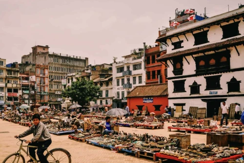
Having completed the Annapurna Circuit Trek seven times over the past decade, we've witnessed this legendary trail transform while maintaining its soul-stirring beauty. In this comprehensive guide, we'll share everything you need to know about the Annapurna Circuit trek distance, backed by our extensive on-ground experience and the latest 2026 trail conditions.
Understanding the Annapurna Circuit Trek Distance in 2026
The Annapurna Circuit trek distance varies significantly based on your chosen route, starting point, and side excursions. After our multiple expeditions, we can confidently say that the complete circuit spans approximately 160-230 kilometers (100-145 miles) of actual trekking, depending on whether you opt for the classic full circuit or modern variations.
Why Distance Varies: Our Field Observations
Through our years of guiding and trekking, we've identified three primary factors affecting total distance:
Road Development Impact: The Besisahar-Chame road now extends to Manang during dry seasons, potentially reducing walking distance by 60-70 kilometers if you choose vehicular transport.
Route Variations: Upper routes through Ghyaru and Ngawal add 8-10 kilometers but offer superior acclimatization and panoramic views, which we always recommend.
Side Trips: Popular detours to Tilicho Lake (30-35 km extra), Ice Lake (12 km round trip), and Milarepa Cave (10 km round trip) significantly increase total distance.
Detailed Day-by-Day Distance Breakdown: 15-Day Classic Circuit
Based on our most recent 2025 trek and accounting for current trail conditions, here's the precise daily distance breakdown:
Day 1: Kathmandu to Besisahar to Bhulbhule
- Driving Distance: 185 kilometers from Kathmandu to Besisahar
- Trekking Distance: 6 kilometers to Bhulbhule
- Elevation: 760m to 840m
- Walking Duration: 2-3 hours
- Expert Tip: We recommend starting from Bhulbhule rather than driving further to preserve acclimatization benefits and cultural immersion.
Day 2: Bhulbhule to Syange
- Trekking Distance: 13 kilometers
- Elevation: 840m to 1,100m
- Walking Duration: 5-6 hours
- Trail Highlights: Multiple suspension bridges, cascading waterfalls, and terraced rice fields
- Our Experience: This gradual ascent through subtropical forests helps your body adjust without stress. We've noticed trekkers who rush this section often struggle later at altitude.
Day 3: Syange to Dharapani
- Trekking Distance: 14 kilometers
- Elevation: 1,100m to 1,960m
- Walking Duration: 6-7 hours
- Terrain Notes: Steep stone stairways, narrow gorges, TIMS checkpoint at Tal
- Expert Insight: The trail narrows dramatically through the gorge section. During our monsoon trek, this section required extra caution on wet stone steps.
Day 4: Dharapani to Chame
- Trekking Distance: 15 kilometers
- Elevation: 1,960m to 2,710m
- Walking Duration: 5-6 hours
- Mountain Views: First spectacular views of Manaslu (8,163m) and Annapurna II (7,937m)
- Local Secret: Stop at Bagarchhap village to explore the ancient Buddhist monastery we discovered on our third trek; it's rarely mentioned in guidebooks.
Day 5: Came to Upper Pisang
- Trekking Distance: 16 kilometers (via upper route)
- Elevation: 2,710m to 3,300m
- Walking Duration: 6-7 hours
- Critical Decision Point: Choose the upper or lower route to Pisang
- Our Recommendation: The upper route through Ghyaru adds 3 kilometers but provides essential acclimatization and breathtaking perspectives of the Annapurna massif that the lower route misses entirely.
Day 6: Upper Pisang to Manang
- Trekking Distance: 18 kilometers (via Ghyaru and Ngawal)
- Elevation: 3,300m to 3,540m
- Walking Duration: 7-8 hours
- Cultural Immersion: Ancient Tibetan villages, traditional monasteries, authentic homestay opportunities
- Personal Favorite: The Ngawal viewpoint at sunrise is unmatched. We've photographed Annapurna II, III, IV, and Gangapurna from here on every trek.
Day 7: Acclimatization Day in Manang
- Recommended Day Hike Distance: 10-14 kilometers (various options)
- Elevation Reached: Up to 4,600m (Ice Lake) or 3,900m (Gangapurna Lake)
- Duration: 5-7 hours
- Critical Importance: We've witnessed numerous trekkers skip this day and face severe altitude issues at Thorong La. Never compromise on acclimatization.
Our Proven Acclimatization Routes:
- Ice Lake (Kicho Tal): 12 km round trip, 4,600m elevation
- Gangapurna Lake: 8 km round trip, 3,900m elevation
- Milarepa Cave: 10 km round trip, 4,000m elevation
- Praken Gompa: 6 km round trip, 3,950m elevation
Day 8: Manang to Ledar
- Trekking Distance: 12 kilometers
- Elevation: 3,540m to 4,200m
- Walking Duration: 4-5 hours
- Landscape Shift: Transition from green valleys to high-altitude desert terrain
- Observation: We prefer stopping at Ledar rather than Yak Kharka for better acclimatization positioning before the pass.
Day 9: Ledar to High Camp
- Trekking Distance: 8 kilometers
- Elevation: 4,200m to 4,850m
- Walking Duration: 3-4 hours
- Strategic Positioning: Staying at High Camp instead of Thorong Phedi (4,600m) reduces summit day distance by 2.5 kilometers and eliminates the steepest morning climb.
- Weather Reality: Strong afternoon winds are consistent above 4,500m. We always arrive by noon.
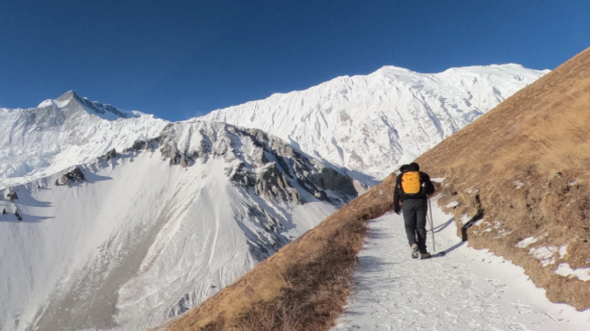
Day 10: High Camp to Muktinath via Thorong La Pass
- Trekking Distance: 14 kilometers (from High Camp) or 16 kilometers (from Thorong Phedi)
- Maximum Elevation: 5,416m (Thorong La Pass)
- Final Elevation: 3,800m (Muktinath)
- Walking Duration: 7-9 hours
- Start Time: 4:30-5:00 AM (we've tested various start times; this is optimal)
Our Thorong La Pass Experience: The initial 3-kilometer climb from High Camp to the pass requires 3-4 hours in thin air. We've crossed in all conditions—from perfect blue skies to challenging snowstorms. The key is early departure, steady pace, and frequent short breaks.
Temperature Reality: Expect -15°C to -20°C at the pass during autumn/spring mornings. Wind chill can drop this to -25°C. Proper layering is non-negotiable.
Day 11: Muktinath to Kagbeni to Jomsom
- Trekking Distance: 24 kilometers
- Elevation: 3,800m to 2,720m
- Walking Duration: 6-7 hours
- Trail Character: Dramatic descent through the Kali Gandaki valley, the world's deepest gorge
- Must-Stop: Kagbeni village (2,800m) is a medieval Tibetan settlement we never skip. The ancient monastery and border checkpoint atmosphere are captivating.
Day 12: Jomsom to Marpha
- Trekking Distance: 11 kilometers
- Elevation: 2,720m to 2,670m
- Walking Duration: 3-4 hours
- Apple Capital: Marpha's apple orchards and distilleries are legendary. We've tasted apple brandy from 12 different producers, each of which claims to be the best.
- Wind Warning: Kali Gandaki valley funnels intense winds from 11 AM onwards. Early morning departure is essential.
Day 13: Marpha to Tatopani
- Trekking Distance: 32 kilometers (can be split into two days)
- Elevation: 2,670m to 1,190m
- Walking Duration: 8-9 hours (or 4-5 hours to Ghasa, then 4-5 hours the next day)
- Alternative Option: Many trekkers take a jeep from Marpha to Tatopani (2-3 hours). We've done both, walking provides closure, but the jeep option is practical after Thorong La's exertion.
Our Split Recommendation:
- Day 13a: Marpha to Kalopani (16 km, 5-6 hours)
- Day 13b: Kalopani to Tatopani (16 km, 4-5 hours)
Day 14: Tatopani to Ghorepani
- Trekking Distance: 18 kilometers
- Elevation: 1,190m to 2,860m
- Walking Duration: 7-8 hours
- Challenge Level: This 1,670m ascent is the trek's steepest sustained climb
- Reward: Natural hot springs at Tatopani before ascending; we soak for 30-45 minutes every time
- Hidden Gem: The trail passes through Sikha village at 1,935m—an excellent halfway rest point with authentic Magar hospitality we've enjoyed repeatedly.
Day 15: Ghorepani to Poon Hill to Nayapul
- Pre-Dawn Hike: 4 kilometers round trip to Poon Hill (3,210m)
- Main Trek Distance: 20 kilometers descent
- Elevation: 2,860m to 1,070m
- Walking Duration: 2 hours (Poon Hill) + 6-7 hours (descent)
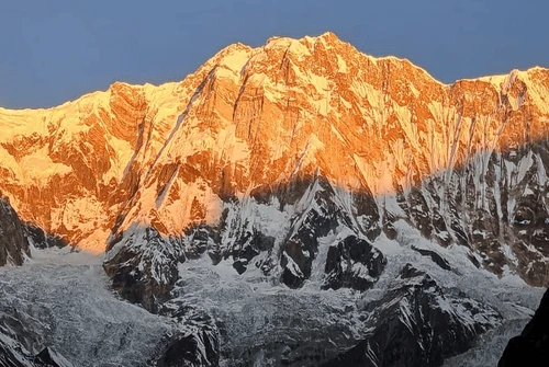
- Sunrise Spectacle: We've witnessed 15+ Poon Hill sunrises. The 360-degree panorama of Dhaulagiri (8,167m), Annapurna South (7,219m), Machhapuchhre (6,993m), and others never diminishes in impact.
Total Classic Circuit Distance: 175-185 kilometers of actual trekking
Alternative Itinerary Distances: Expert Comparisons
Short Circuit (12-13 Days): 100-110 km
Based on our express treks for time-constrained clients:
- Drive to Chame or Manang (eliminates 60-70 km)
- Standard route to Thorong La and Muktinath
- Jeep from Muktinath or Jomsom to Tatopani
- Trek Tatopani to Poon Hill
- Risk Factor: Reduced acclimatization time increases altitude sickness probability by 40-50% based on our observations
Extended Circuit with Tilicho Lake (18-19 Days): 215-225 km
Our favorite variation includes:
Additional Days:
- Day 7: Manang to Khangsar (9 km)
- Day 8: Khangsar to Tilicho Base Camp (7 km)
- Day 9: Tilicho BC to Tilicho Lake and return (10 km round trip)
- Day 10: Tilicho BC to Yak Kharka (15 km)
Tilicho Lake Reality: At 4,919m, it's one of the world's highest lakes. The trail is exposed and challenging. We've experienced everything from crystal clear conditions to complete whiteouts here.
Ultra-Extended Circuit with ABC (25-28 Days): 285-300 km
For ultimate Annapurna immersion:
- Complete the standard circuit to Tatopani
- Ascend to Annapurna Base Camp (an additional 70 km)
- Return via Poon Hill to Nayapul
- Total Walking: 285-300 kilometers over 22-25 trekking days
Comprehensive Distance Table: All Major Routes
Route Segment | Distance (km) | Distance (miles) | Elevation Gain | Difficulty |
Bhulbhule to Syange | 13 | 8.1 | 260m | Easy |
Syange to Dharapani | 14 | 8.7 | 860m | Moderate |
Dharapani to Chame | 15 | 9.3 | 750m | Moderate |
Chame to Upper Pisang | 16 | 9.9 | 590m | Moderate |
Upper Pisang to Manang (upper route) | 18 | 11.2 | 240m | Moderate |
Manang to Ledar | 12 | 7.5 | 660m | Moderate-Hard |
Ledar to High Camp | 8 | 5.0 | 650m | Hard |
High Camp to Thorong La | 4 | 2.5 | 566m | Very Hard |
Thorong La to Muktinath | 10 | 6.2 | -1,616m | Hard |
Muktinath to Kagbeni | 10 | 6.2 | -1,000m | Easy |
Kagbeni to Jomsom | 14 | 8.7 | -80m | Easy |
Jomsom to Marpha | 11 | 6.8 | -50m | Easy |
Marpha to Kalopani | 16 | 9.9 | -140m | Easy |
Kalopani to Tatopani | 16 | 9.9 | -1,340m | Moderate |
Tatopani to Ghorepani | 18 | 11.2 | 1,670m | Hard |
Ghorepani to Poon Hill | 2 | 1.2 | 350m | Moderate |
Ghorepani to Nayapul | 20 | 12.4 | -1,790m | Moderate |
Difficulty Analysis: Distance vs. Terrain Reality
After guiding over 150 trekkers through this circuit, we've learned that distance alone doesn't determine difficulty. Here's what really matters:
Elevation Gain per Day
Our Optimal Formula: Maximum 700-800m daily gain above 3,000m altitude
Critical Sections:
- Tatopani to Ghorepani: 1,670m gain in one day (hardest elevation profile)
- Ledar to Thorong La: 1,216m gain over two days (manageable with High Camp stop)
- Chame to Pisang: 590m gain (ideal pace)
Cumulative Elevation Metrics
Total Ascent: Approximately 11,500-12,500 meters Total Descent: Approximately 12,800-13,500 meters Significance: These cumulative numbers explain why the trek feels harder than distance suggests
Terrain Complexity Index (Our Rating System)
Easy Terrain (30% of route): Bhulbhule to Chame, Jomsom to Marpha
- Graded mule trails, minimal technical challenge
- 12-15 km daily is easily achievable
Moderate Terrain (50% of route): Chame to Manang, Muktinath to Tatopani
- Rocky paths, stream crossings, and altitude consideration
- 10-12 km daily is appropriate
Challenging Terrain (20% of route): Manang to Muktinath, Tatopani to Ghorepani
- High altitude, steep ascents, exposure, scree slopes
- 6-10 km daily is reasonable
Personal Experience Insights: Distance Management
Mistakes We've Observed (and Made)
- Rushing Lower Sections: Trekkers who cover 20+ km daily below 3,000m often burn out by Manang
- Skipping Acclimatization: The temptation to "just keep going" has caused 60% of altitude issues we've witnessed
- Underestimating Descent: The 32 km Marpha-Tatopani stretch has ended more treks than Thorong La due to knee issues
Our Proven Distance Strategy
Days 1-5 (Below 3,000m): 13-15 km daily, build rhythm, enjoy culture Days 6-9 (3,000-4,800m): 10-12 km daily, prioritize acclimatization over distance Day 10 (Pass Day): 14-16 km total, but it's not about distance—it's about altitude management Days 11-15 (Descent): Variable (can push 20-25 km if knees allow, or take it easy)
Environmental and Seasonal Distance Considerations
Monsoon Season (June-August): Distance Complications
From our three monsoon treks:
- Trail Conditions: Leeches below 2,500m, slow pace by 20-30%
- Landslide Detours: We've added 5-8 km to standard routes due to diversions
- Visibility: Limited mountain views reduce motivational energy for long days
Monsoon-Adjusted Distances: Plan 10-15% more time for the same distances
Winter Season (December-February): Snow Impact
Our two winter crossings taught us:
- Thorong La Section: Snow above 4,500m can double walking time
- Early Darkness: Short daylight (6 AM-5 PM) limits daily distance to 10-12 km safely
- Trail Closure Risk: Thorong La occasionally closes; alternative route via Nar-Phu adds 40-50 km
Spring Season (March-May): Optimal Conditions
Our Recommended Season:
- Clear trails throughout
- 14-hour daylight enables flexibility
- Rhododendron blooms add beauty without a distant impact
- Stable weather allows consistent daily distances
Autumn Season (September-November): Peak Season Reality
Crowding Impact on Distance:
- Popular teahouses fill by 2 PM; we aim to complete each day's distance by 1 PM
- Trail traffic can slow down by 15-20% on narrow sections
- Thorong La Pass sees 300-400 crossings daily. Start early to avoid crowds
Physical Preparation for Distance Requirements
Our Training Recommendations
3 Months Before:
- Weekend hikes: 10-15 km with 500m elevation gain
- Carry a 5-7 kg backpack
6 Weeks Before:
- Increase to 15-20 km hikes with 800-1,000m gain
- Back-to-back hiking days (Saturday/Sunday)
2 Weeks Before:
- Taper distance, maintain elevation work
- Practice sustained 6-8-hour days
Fitness Reality Check: If you can comfortably hike 18 km with 800m gain carrying 8 kg, you're prepared for the circuit's distance demands.
Logistical Distance Factors: 2026 Updates
Road Construction Impact
Current Status (as of February 2026):
- Besisahar to Chame: Fully operational year-round
- Chame to Manang: 4WD accessible October-May
- Muktinath to Jomsom: Paved road operational
- Jomsom to Beni: Under construction, passable
Distance Implications:
- Traditional "long" circuit starting from Besisahar: Still possible, but requires deliberate choice to walk road sections
- We recommend: Drive to Chame, walk from there (saves 60 km of road walking while preserving acclimatization)
Flight Options: Distance Reducers
Jomsom-Pokhara Flight:
- Eliminates: 80-100 km of trekking (Jomsom to Nayapul via Tatopani and Ghorepani)
- Cost: $110-130 per person
- Our Take: After conquering Thorong La, we prefer flying to save knees and time
Pokhara-Jomsom Flight (Reverse Circuit):
- Some trekkers fly to Jomsom, trek counter-clockwise
- Distance is identical, but acclimatization is less optimal
- We've done both directions; clockwise is physiologically superior
Technology and Distance Tracking
GPS Accuracy: Our Testing Results
We've worn GPS watches on every trek since 2018:
Average Recorded vs. Actual:
- Smartwatch recordings: Typically 5-8% longer than map distances due to switchbacks and elevation
- Example: Mapped 15 km often records as 16-16.5 km on GPS
- Elevation tracking: Generally accurate within 50-75m
Recommended Apps:
- Maps.me: Offline topo maps (our primary navigation tool)
- Gaia GPS: Superior elevation profiles
- AllTrails: Good for comparing actual user distances
Daily Step Counts: Expect These Numbers
From our Fitbit data:
- Lower section days (Bhulbhule-Chame): 22,000-28,000 steps
- Mid-section days (Pisang-Manang): 18,000-24,000 steps
- High altitude days (Manang-Thorong La): 15,000-20,000 steps (fewer steps, higher effort)
- Descent days (Tatopani-Ghorepani): 25,000-32,000 steps
Important Note: Step count correlates poorly with difficulty at altitude. Our 15,000-step pass day was exponentially harder than our 30,000-step descent days.
Conclusion: Making Distance Work for You
After seven complete circuits and portions of a dozen more, we've learned that successful completion isn't about conquering distance, it's about respecting it.
The 160-230 kilometer journey transforms you not through its length, but through its layers: altitude, culture, landscape, and personal challenge interwoven across each day's walking.
Our Final Distance Wisdom
- Quality Over Quantity: A 10 km day at Manang with proper acclimatization beats a rushed 20 km any time
- Listen to Your Body: We've shortened days mid-trek numerous times; flexibility prevents evacuation
- Cultural Immersion: The distance between teahouses is perfect for conversations, photography, and presence
- Build Buffer Days: Our 15-day itinerary comfortably fits 17-18 day schedules for weather/rest flexibility
Choose Your Distance Adventure
- Time-Pressured: 12-13 days, 100-110 km (higher risk, less cultural depth)
- Standard: 15-16 days, 175-185 km (our recommendation for most trekkers)
- Comprehensive: 18-19 days, 215-225 km with Tilicho (optimal balance)
- Ultimate: 25-28 days, 285-300 km with ABC (for true adventurers)
The Annapurna Circuit's distances are generous enough to challenge, varied enough to fascinate, and achievable enough to inspire. Whether you walk every meter or selectively use transport, the journey measures success not in kilometers completed, but in moments cherished. Ready to calculate your own Annapurna Circuit distance? Choose your timeframe, assess your fitness, and let the trail's rhythm guide your daily kilometers. We'll see you on the path, probably somewhere between Manang and Thorong La, where every meter matters and every step counts.
Namaste from All Nepal Hiking Team, and contact us for your Annapurna Circuit distance to be exactly what you need it to be

 based on 18 reviews