based on 270 reviews


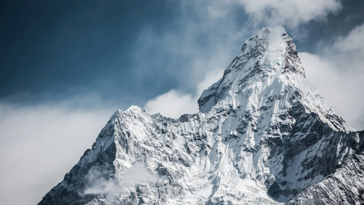
The Himalayas are located in South and Central Asia, stretching roughly 2,400 kilometers (1,500 miles) across five core countries: Nepal, India, China (Tibet), Bhutan, and Pakistan.
Forming a natural wall between the lush plains of the Indian subcontinent and the high Tibetan Plateau, this massive mountain arc holds the highest peaks on Earth—including Mount Everest (8,848.86 m).
Whether you are planning a bucket-list Himalayan trek, researching world geography, or curious about the cultures that call these high valleys home, here is the complete, easy-to-read guide to where the Himalayas are located and what makes them extraordinary.
Quick Facts About the Himalayas
| Feature | Key Fact |
|---|---|
| Continent | Asia (South and Central Asia) |
| Core Countries | Nepal, India, China (Tibet), Bhutan, and Pakistan |
| Total Length | ~2,400 km (1,500 miles) from west to east |
| Width | 150 km to 400 km (north to south) |
| Highest Peak | Mount Everest / Sagarmatha / Chomolungma (8,848.86 m / 29,032 ft) |
| Meaning of Name | Sanskrit Hima (snow) + Alaya (abode) = "Abode of Snow" |
| Major Rivers Fed | Indus, Ganges, Brahmaputra, and Yamuna |
Where Are the Himalayas on a Map?
On a world map, the Himalayas look like a giant, snow-white crescent curving across southern Asia.
- Western Anchor: The range begins near the Indus River valley around Nanga Parbat (8,126 m) in northern Pakistan, where it meets the Karakoram and Hindu Kush ranges.
- Central Core: It sweeps southeast across northern India and runs directly through the entire northern length of Nepal, where the peaks reach their greatest heights.
- Eastern Anchor: It continues through Bhutan and northeastern India, ending near Namcha Barwa (7,782 m) at the bend of the Brahmaputra River in Tibet.
Major gateway cities near the range include Kathmandu (Nepal), Leh and Manali (India), Paro (Bhutan), and Lhasa (Tibet).
The 5 Countries That Share the Himalayas
No single nation owns the entire Himalayan range. Instead, five countries share its peaks, valleys, and glaciers:
1. Nepal (The Central Heart & Highest Peaks)
Nepal holds the central and most dramatic section of the Himalayas. Roughly 75% of Nepal is mountainous, and the country contains 8 of the world’s 14 highest mountains (peaks above 8,000 meters), including Mount Everest, Kanchenjunga, Lhotse, Makalu, Cho Oyu, Dhaulagiri, Manaslu, and Annapurna I. Because of its well-established trails, teahouses, and easy access from Kathmandu, Nepal is the world’s premier destination for Himalayan trekking.
2. India (Five Northern States)
The Indian Himalayas run across five northern and northeastern states:
- Ladakh & Jammu and Kashmir: High-altitude cold deserts, ancient monasteries, and dramatic passes.
- Himachal Pradesh: Green pine valleys and hill stations like Manali and Shimla.
- Uttarakhand: Sacred Hindu pilgrimage sites (Gangotri, Yamunotri, Kedarnath, Badrinath) and peaks like Nanda Devi.
- Sikkim: Home to the Indian side of Kanchenjunga (8,586 m) and alpine lakes.
- Arunachal Pradesh: Remote, forested eastern ridges bordering Tibet and Bhutan.
3. China / Tibet (The Northern Flank)
The northern slopes of the Himalayas rise directly out of the Tibetan Plateau (averaging over 4,500 meters in elevation). This region houses the north face of Mount Everest (known locally as Chomolungma), Shishapangma, and sacred Mount Kailash. Because it sits in the mountain rain shadow, the Tibetan side is much drier and more arid than Nepal or India.
4. Bhutan (The Eastern Kingdom)
Tucked into the eastern Himalayas, Bhutan preserves a deeply spiritual, low-impact mountain environment. It is home to Gangkhar Puensum (7,570 m), the highest unclimbed mountain in the world—mountaineering above 6,000 meters is prohibited in Bhutan out of respect for local spiritual beliefs.
5. Pakistan (The Western Edge)
Pakistan holds the far western tip of the Himalayas in the Gilgit-Baltistan region, anchored by Nanga Parbat (8,126 m). Here, the Himalayas merge into the neighboring Karakoram Range (home to K2).
How Were the Himalayas Formed?
Around 50 to 65 million years ago, the Indian tectonic plate drifted northward across the ancient Tethys Ocean and collided with the Eurasian plate.
Because both landmasses were made of light continental rock, neither plate sank completely. Instead, the Earth’s crust crumpled, folded, and pushed upward—forming the towering peaks we see today. Even marine fossils from the ancient sea floor have been found near the summit of Mount Everest.
This tectonic collision is still active, meaning the Himalayas continue to rise by a few millimeters every year.
The 4 Parallel Mountain Ranges of the Himalayas
Geographers divide the Himalayas from south to north into four parallel zones:
- The Outer Himalayas (Siwalik Hills): The southernmost, lowest foothills (900–1,200 m), covered in dense subtropical forests and fertile valleys.
- The Lesser Himalayas (Himachal): The middle band (3,700–4,500 m) featuring terraced farmlands, rhododendron forests, and scenic hill towns.
- The Great Himalayas (Himadri): The highest, snow-covered central spine containing Mount Everest and all the world’s 8,000-meter Himalayan giants.
- The Tibetan / Tethys Himalayas: The northern transition zone merging into the high, dry Tibetan Plateau.
Tallest Peaks in the Himalayas
While there are thousands of named peaks across the range, these iconic summits stand above 8,000 meters (26,247 feet):
| Rank | Peak Name | Elevation | Location |
|---|---|---|---|
| 1 | Mount Everest (Sagarmatha) | 8,848.86 m (29,032 ft) | Nepal / China (Tibet) |
| 2 | Kanchenjunga | 8,586 m (28,169 ft) | Nepal / India |
| 3 | Lhotse | 8,516 m (27,940 ft) | Nepal / China (Tibet) |
| 4 | Makalu | 8,485 m (27,838 ft) | Nepal / China (Tibet) |
| 5 | Cho Oyu | 8,188 m (26,864 ft) | Nepal / China (Tibet) |
| 6 | Dhaulagiri I | 8,167 m (26,795 ft) | Nepal |
| 7 | Manaslu | 8,163 m (26,781 ft) | Nepal |
| 8 | Nanga Parbat | 8,126 m (26,660 ft) | Pakistan |
| 9 | Annapurna I | 8,091 m (26,545 ft) | Nepal |
| 10 | Shishapangma | 8,027 m (26,335 ft) | China (Tibet) |
(Note: K2, the world’s second-highest peak at 8,611 m, sits in the adjacent Karakoram Range rather than the main Himalayan chain.)
People, Culture & Wildlife of the Himalayas
The Himalayas are far more than rock and ice—they are a living cultural and ecological sanctuary.
- Indigenous Communities: For centuries, mountain communities have thrived at high altitudes, including the Sherpa in the Everest region, the Gurung and Magar in Annapurna, the Tamang in Langtang, and the Limbu and Rai in eastern Nepal.
- Spiritual Heritage: Both Hinduism and Tibetan Buddhism view the Himalayas as sacred. Ancient monasteries (like Tengboche and Mu Gompa), stone mani walls, prayer flags, and sacred peaks like Mount Kailash and Machapuchare draw pilgrims from around the world.
- Rare Wildlife: The alpine forests and snowfields shelter elusive species including the Snow Leopard, Red Panda, Himalayan Tahr, Blue Sheep, and Nepal’s colorful national bird, the Himalayan Monal (Danphe).
- Water Lifeline of Asia: Roughly 15,000 Himalayan glaciers feed major river systems—including the Ganges, Indus, and Brahmaputra—that sustain over a billion people downstream.
Best Himalayan Treks to Experience in Nepal
Because Nepal holds the highest concentration of 8,000-meter peaks and welcoming mountain villages, it offers the world’s most rewarding trekking trails for every fitness level:
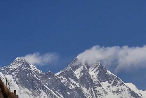
- For Iconic High-Altitude Views: Follow in the footsteps of mountaineering legends on the Everest Base Camp Trek (5,545 m at Kala Patthar), surrounded by Sherpa culture and views of Everest, Lhotse, and Ama Dablam.
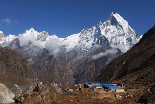
- For Dramatic Amphitheaters & Short Schedules: Hike into a natural bowl of towering 7,000m and 8,000m peaks on the Annapurna Base Camp Trek (4,130 m), passing through lush rhododendron forests and Gurung villages.
- For Raw, Uncrowded Wilderness: Circle the world’s eighth-highest mountain and cross the dramatic Larkya La pass (5,106 m) on the Manaslu Circuit Trek, a remote alternative to busy trails.
- For Easy Access Near Kathmandu: Explore glacial valleys, sacred lakes, and Tamang heritage just north of the capital on the Langtang Valley Trek.
- For First-Time & Beginner Hikers: Discover scenic sunrise ridges and manageable altitudes in our guide to the Best Beginner Treks in Nepal.
When Is the Best Time to Visit?
The two best seasons for trekking in the Himalayas are Autumn (September to November), which brings crystal-clear post-monsoon mountain views, and Spring (March to May), when daytime temperatures warm up and hillsides burst with blooming red and pink rhododendrons.
Plan Your Himalayan Adventure with All Nepal Hiking
Seeing the Himalayas on a map is inspiring—walking beneath them is unforgettable. At All Nepal Hiking, our Kathmandu-based, government-registered team of licensed local guides crafts safe, personalized trekking and cultural journeys across Everest, Annapurna, Manaslu, Langtang, and Nepal’s hidden valleys.
Ready to experience the roof of the world firsthand? Contact All Nepal Hiking today to start planning your Himalayan trek.
Frequently Asked Questions (FAQs)
Are Mount Everest and the Himalayas the same thing?
No. The Himalayas are the entire 2,400-kilometer-long mountain range stretching across five Asian countries, while Mount Everest (8,848.86 m) is the single tallest peak located within that range.
Which country has the most of the Himalayas?
Nepal holds the central and highest portion of the range, containing 8 of the world’s 14 peaks over 8,000 meters, while India administers the longest geographic stretch of Himalayan territory across five northern states.
Are the Himalayas still growing?
Yes. Because the Indian tectonic plate continues pushing northward into the Eurasian plate, the Himalayas are still rising by a few millimeters each year.
Do I need a guide to trek in the Nepal Himalayas?
Yes, for most protected conservation areas and national parks in Nepal, hiring a licensed local trekking guide and obtaining official permits (such as TIMS, ACAP, or MCAP) is required for safety and environmental conservation.