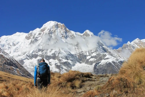
Where Does the Manaslu Trek Start and End?
Starting Point: The journey begins with a scenic 7-to-9-hour drive from Kathmandu to Machha Khola, depending on seasonal road conditions and ongoing rural infrastructure projects. From here, walking on foot officially commences.
Ending Point: The trekking loop concludes at Dharapani, where the Manaslu trail seamlessly merges with the famous Annapurna Circuit. From Dharapani, a local jeep or bus transports you back to Kathmandu via Besisahar.
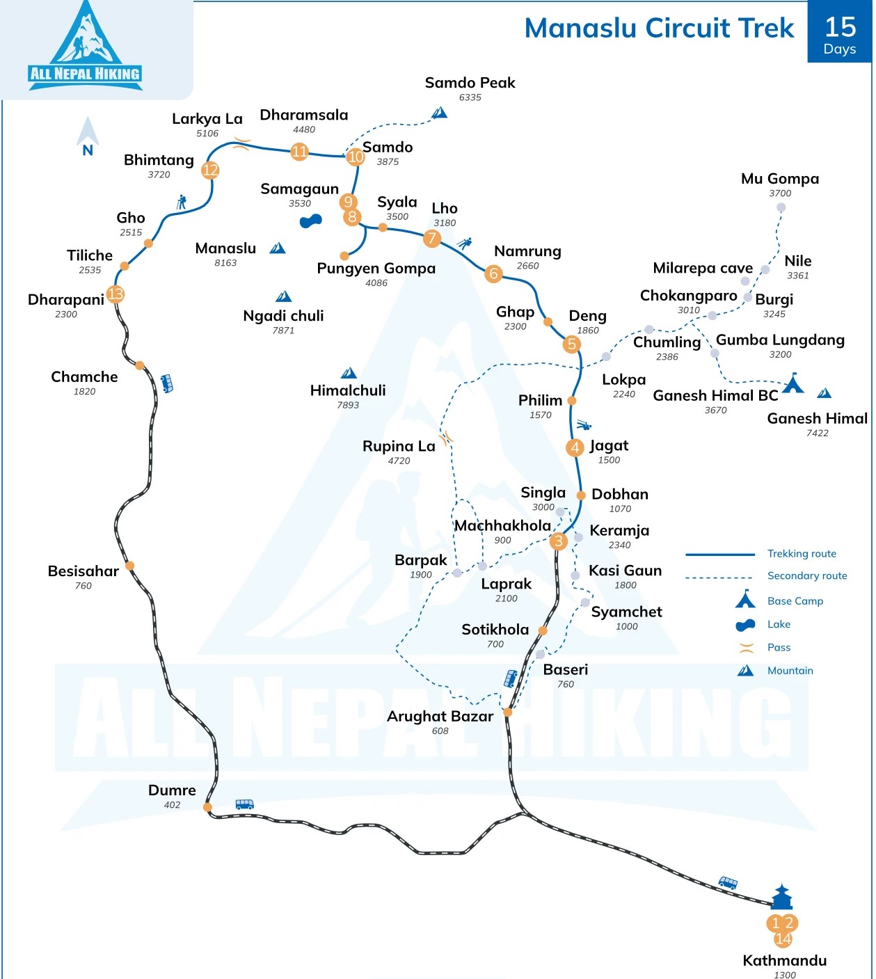
Highlights and Geographical Zones on the Manaslu Circuit Trek Map
Budhi Gandaki River Gorge: A deep, dramatic river gorge featuring dozens of thrilling suspension bridges spanning roaring glacial waters.
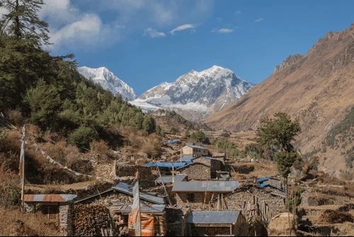
Ancient Tibetan Villages: High-altitude settlements like Lho, Sama Gaon, and Samdo featuring traditional stone houses, ancient monasteries, and an authentic Tibetan culture.
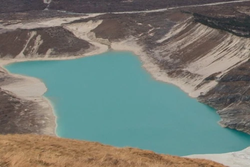
Birendra Lake & Manaslu Base Camp: Spectacular side-trip options near Sama Gaon that provide jaw-dropping views of turquoise glacial waters and the towering south face of Manaslu.
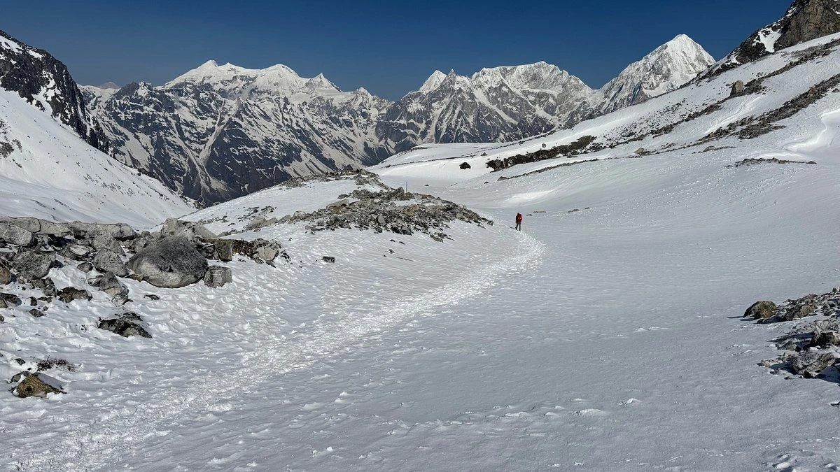
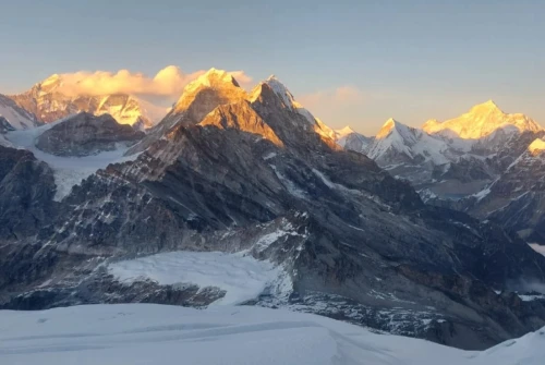
Larkya La Pass (5,106m / 16,752ft): The crown jewel and highest point of the trek, offering a sweeping 360-degree panorama of Himlung Himal, Cheo Himal, Kang Guru, Annapurna II, and the surrounding high-altitude glacial basin.
Geographical Zones on the Map:
The Subtropical Lower Foothills: Beginning at drive-in points like Machha Khola, the trail hugs steep canyon walls, crosses dizzying suspension bridges, and winds past cascading waterfalls and terraced farming hamlets.
The Restricted Entry Corridor: Between Jagat and Philim, the landscape begins to shift. Security checkpoints mark the entry into the restricted zone, and Hindu architecture gradually gives way to Tibetan mani walls, chortens, and prayer wheels.
The High Alpine Basin (Nupri Valley): Settlements like Namrung, Lho, and Samagaon open up into wide, breathtaking glacial valleys framed by colossal ice faces.
The High Pass: The Larkya La Pass (5,106 m / 16,752 ft) is prominently marked as the crown jewel and physical peak of the entire trek.
Manaslu Circuit Trek Distance, Elevation Profile & Acclimatization
The total foot-walking distance of the Manaslu Circuit Trek covers approximately 177 km (110 miles) once you begin tracking from Soti Khola and conclude at Dharapani. Depending on your specific starting point (such as Soti Khola or Machha Khola), ending location, and side excursions, the overall distance and daily pacing can vary.
Reliable trekking maps for the Manaslu Circuit also outline major regional extensions, such as the Tsum Valley Trek, the Nar Phu Valley Trek, or continuing onward to combine the route with the Annapurna Circuit Trek.
Typically, a standard Manaslu Circuit Trekking Itinerary spans 12 to 15 days. With over two decades of expertise in organizing All Nepal Hiking serves as your trusted local partner for safe, well-paced, and unforgettable adventures in Nepal.
Standard Day-by-Day Distance and Altitude
Day | Route / Trail | Approx. Distance | Duration | Elevation Gain / Loss |
Day 1 | Kathmandu to Soti Khola (Drive) | 140–160 km (Drive) | 7–9 hrs | 710 m |
Day 2 | Soti Khola to Machha Khola | 14 km (9 miles) | 5–6 hrs | 710m to 869m |
Day 3 | Machha Khola to Jagat | 15 km (9.3 miles) | 5–6 hrs | 869m to 1,340m |
Day 4 | Jagat to Deng | 19 km (11.8 miles) | 7–8 hrs | 1,340m to 1,860m |
Day 5 | Deng to Namrung | 19 km (12 miles) | 6–7 hrs | 1,860m to 2,630m |
Day 6 | Namrung to Sama Gaon | 17 km (10.5 miles) | 6–7 hrs | 2,630m to 3,520m |
Day 7 | Acclimatization Day (Sama Gaon) | 5–12 km (Optional side hikes) | 4–6 hrs | 3,520m (Rest day) |
Day 8 | Sama Gaon to Samdo | 8 km (4.9 miles) | 3–4 hrs | 3,520m to 3,790m |
Day 9 | Samdo to Dharamsala (Larkya Phedi) | 6.5 km (4 miles) | 4–5 hrs | 3,790m to 4,450m |
Day 10 | Dharamsala to Bimthang via Larkya La Pass | 23–25 km (14–15 miles) | 8–10 hrs | 4,450m to 5,160m (Pass) down to 3,700m |
Day 11 | Bimthang to Tilije to Dharapani | 22 km (13.6 miles) | 7–8 hrs | 3,700m to 1,860m |
Day 12 | Dharapani to Kathmandu (Drive) | 180–220 km (Drive) | 8–10 hrs | 1,860m to 1,400m |
Pro-Tip on Map Reading and Route Planning:
Utilizing your Manaslu Circuit Trek map helps you monitor daily elevation gains, identify essential water sources, and accurately track structural checkpoints. Because altitude jumps become more pronounced past Sama Gaon, treating acclimatization stops as non-negotiable safeguards ensures a much safer and more rewarding journey.
Altitude Gain and Acclimatization on the Manaslu Circuit Trek
Embarking on the Manaslu Circuit Trek means spending multiple days hiking well above 3,000 meters (9,842 feet), where atmospheric pressure drops and oxygen levels are significantly lower, roughly one-third less than at sea level. A rapid ascent without proper pacing and acclimatization puts trekkers at serious risk of Acute Mountain Sickness (AMS).
Studying a detailed Manaslu Circuit Trek map with elevation profiles is vital. It allows you to visualize daily altitude gains, align your pacing to natural acclimatization milestones, explore side valleys safely, and minimize high-altitude risks.
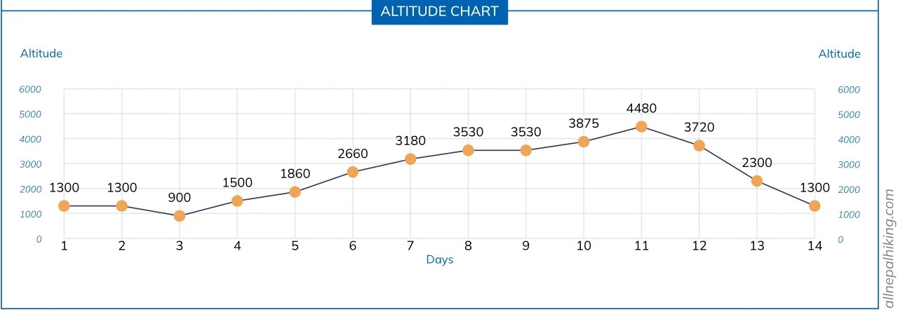
Understanding the Elevation Profile
Lower Foothills (Soti Khola to Sama Gaon): Starting from Soti Khola (710m), the trail gradually climbs through river gorges and alpine forests. Daily elevation gains average between 400 meters and 700 meters, allowing your body to adapt progressively as you transition into the high-altitude zone at Sama Gaon (3,520m).
The High-Altitude Push (Sama Gaon to Larkya La Pass): Beyond Sama Gaon, altitude impacts become pronounced. The push from Dharamsala (4,450m) up to the summit of Larkya La Pass (5,160m / 16,929ft) represents a massive physical challenge, requiring a major elevation gain of over 700 meters to reach the crest, followed by a steep descent of roughly 1,460 meters down to Bimthang (3,700m).
The Descent (Bimthang to Dharapani): From Bimthang onward, the trek features a consistent, moderate loss in elevation daily as you descend through rhododendron and pine forests until merging with the Annapurna trail at Dharapani (1,860m).
Expert Altitude Safety Tips for Your Map:
Built-In Acclimatization: Always schedule dedicated rest days on your map typically at Sama Gaon (3,520m) with active day hikes to higher points like Pungyen Gompa or Manaslu Base Camp (following the "climb high, sleep low" rule).
Hydration & Nutrition: Drink 3 to 4 liters of water daily and maintain a carbohydrate-rich diet to fuel your ascent.
Listen to Your Body: Use your route map to identify bailout routes and monitor symptoms of altitude sickness closely. Never push through persistent headaches, dizziness, or nausea without consulting your guide.
Manaslu Circuit Trek Itineraries: 12-Day, 14-Day & 15-Day Map Breakdowns
Manaslu Trekking Map: 12-Days Itinerary
The 12-day Manaslu Circuit Trek itinerary is a fast-paced yet well-structured expedition designed for trekkers with good physical fitness. Below is the day-by-day breakdown mapping out the routes, elevations, and key geographic milestones.
Day 1: Drive from Kathmandu to Machha Khola (869 m / 2,851 ft)
Day 2: Trek from Machha Khola to Jagat (1,340 m / 4,397 ft)
Day 3: Trek from Jagat to Deng (1,860 m / 6,109 ft)
Day 4: Trek from Deng to Namrung (2,630 m / 8,629 ft)
Day 5: Trek from Namrung to Lho (3,180 m / 10,433 ft)
Day 6: Trek from Lho to Samagaon (3,530 m / 11,581 ft)
Day 7: Acclimatization Day at Samagaon (3,530 m / 11,581 ft)
Day 8: Trek from Samagaon to Samdo (3,860 m / 12,660 ft)
Day 9: Trek from Samdo to Dharamsala / Larkya La Phedi (4,460 m / 14,632 ft)
Day 10: Cross Larkya La Pass (5,160 m / 16,929 ft) to Bhimtang (3,590 m / 11,778 ft)
Day 11: Trek from Bhimtang to Dharapani (1,960 m / 6,430 ft)
Day 12: Drive from Dharapani to Kathmandu (1,400 m / 4,593 ft)
Manaslu Circuit Trek 14-Day Map
The 14-day Manaslu Circuit Trek itinerary offers a brilliantly balanced, optimized route for experiencing the remote wilderness, towering peaks, and rich Tibetan Buddhist culture of the Mansiri Himal range. Below is the comprehensive day-by-day mapping of your trek, complete with elevations, trail segments, and key geographical highlights.
Day 1: Arrival in Kathmandu (1,400 m / 4,593 ft)
Day 2: Drive from Kathmandu to Machha Khola (930 m / 3,051 ft)
Day 3: Trek from Machha Khola to Jagat (1,340 m / 4,396 ft)
Day 4: Trek from Jagat to Deng (1,804 m / 5,918 ft)
Day 5: Trek from Deng to Namrung (2,630 m / 8,629 ft).
Day 6: Trek from Namrung to Syala (3,520 m / 11,548 ft)
Day 7: Trek from Syala to Samagaon (3,530 m / 11,582 ft) via Pungen Gompa (4,000 m / 13,124 ft)
Day 8: Acclimatization Day in Samagaon (3,530 m / 11,582 ft)
Day 9: Trek from Samagaon to Samdo (3,875 m / 12,713 ft)
Day 10: Trek from Samdo to Dharmashala / Larkya Phedi (4,460 m / 14,633 ft)
Day 11: Trek from Dharmashala to Bimthang via Larkya La Pass (5,106 m / 16,752 ft)
Day 12: Trek from Bimthang to Dharapani via Tilche (1,860 m / 6,102 ft)
Day 13: Drive from Dharapani to Kathmandu – Return Journey & Farewell Dinner
Day 14: International Departure
Manaslu Circuit Trek Map: 15-Day Recommended Itinerary
For most trekkers, the 15-day Manaslu Circuit Trek itinerary is the gold standard. It provides a safer, more relaxed pace with optimal altitude acclimatization, reducing the risk of mountain sickness and leaving plenty of time to enjoy side excursions (such as adding the Tsum Valley detour if pre-planned).
Below is the comprehensive, day-by-day mapping of your 15-day Himalayan adventure:
Day 1: Arrival at Tribhuvan International Airport (TIA)
Day 2: Trek Preparations & Permit Processing
Day 3: Drive from Kathmandu to Machha Khola (869 m / 2,851 ft)
Day 4: Trek from Machha Khola to Jagat (1,340 m / 4,397 ft)
Day 5: Trek from Jagat to Deng (1,860 m / 6,109 ft)
Day 6: Trek from Deng to Namrung (2,630 m / 8,629 ft)
Day 7: Trek from Namrung to Lho (3,180 m / 10,433 ft)
Day 8: Trek from Lho to Samagaon (3,530 m / 11,581 ft)
Day 9: Acclimatization Day at Samagaon (3,530 m / 11,581 ft)
Day 10: Trek from Samagaon to Samdo (3,860 m / 12,660 ft)
Day 11: Trek from Samdo to Dharamsala / Larkya La Phedi (4,460 m / 14,632 ft)
Day 12: Trek from Dharamsala to Bhimthang (3,720 m / 12,204 ft) via Larkya La Pass (5,160 m / 16,929 ft)
Day 13: Trek from Bhimthang to Dharapani (1,960 m / 6,430 ft)
Day 14: Dharapani to Besisahar by local jeep and drive to Kathmandu
Day 15: Final Departure
Essential Permits Required for the Manaslu Circuit
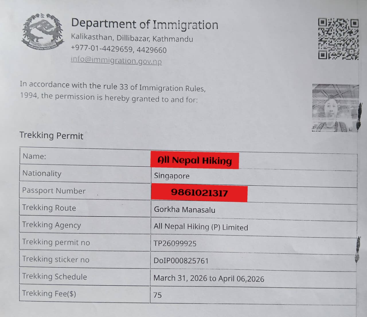
Because the trail runs directly along the sensitive border region with Tibet, independent or solo trekking without an agency is strictly prohibited by the government. You must book your trip through a registered local trekking agency and be accompanied by a government-licensed guide.To legally complete the circuit, you will need three primary authorizations plus a local region fee:
1. Manaslu Restricted Area Permit (RAP)
Cost (by Season):
Peak Season (September – November): USD 100 for the first 7 days, plus USD 15 per extra day.
Off-Season (December – August): USD 75 for the first 7 days, plus USD 10 per extra day.
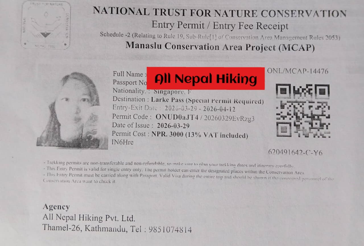
2. Manaslu Conservation Area Permit (MCAP)
3. Annapurna Conservation Area Permit (ACAP)
4. Chumnubri Rural Municipality Local Fee
Essential Tips for Using Your Manaslu Trek Map
Carry a Waterproof Paper Map: Electronics and phone batteries fail rapidly in sub-zero alpine temperatures. Always back up your digital navigation tools with a physical, waterproof paper map of the Manaslu region.
Monitor Daily Elevation Profiles: Review your map and elevation chart every morning with your guide to anticipate steep, grueling stair climbs (especially common on sections like the ascent toward Namrung) and manage your physical pacing.
Know the Checkpoints: Keep your Restricted Area Permits, conservation permits, and passport handy at designated scanning and registration stations clearly marked along the route (such as Jagat and Philim).
Digital vs. Paper Navigation: While offline GPS tracking apps (like Gaia GPS or Maps.me) serve as useful secondary references, heavy reliance on phones can leave you stranded when batteries die in the cold.
Identify Emergency Descent Routes: Familiarize yourself with emergency escape paths and valley exits indicated on your map. If severe symptoms of acute mountain sickness (AMS) strike near the higher camps before Larkya La, the primary safety protocol involves dropping back down rapidly along lower elevation trails toward the Budhi Gandaki valley.
Critical Map Elements to Watch For
Restricted Checkpoints: Pay close attention to where your guide stops for permit scanning and passport verification—specifically at Jagat, Philim, and Deng on the ascent, and near Dharapani when exiting the restricted conservation zones.
Acclimatization Clusters: Notice how contour lines bunch closely together around Sama Gaon and Samdo. Topographic maps explicitly highlight these areas because ascending rapidly past 3,500 meters without a scheduled rest day dramatically increases the risk of Acute Mountain Sickness (AMS).
Side-Trail Options: On detailed topographic maps, look for branching paths leading toward the Tsum Valley (the hidden valley of happiness) or hidden detours like Serang Gompa for trekkers with extra time and a spirit of deeper exploration.
Best Season for Manaslu Circuit Route Planning
One of the most important Manaslu route planning tips is to set off at the right time for a better experience, especially when the trail, road, and flight conditions can be greatly affected by the weather, which in high altitudes in the Nepalese Himalayas is notoriously unpredictable. Even with the best Manaslu Circuit Trekking Route Map, challenges can arise if you pick the wrong time for your trip.
For beginners and experienced trekkers alike, it is advised to book your Manaslu Circuit Trek in spring (March to May) and autumn (September to November). While manageable during the summer/monsoon seasons usually regarded as off-time for high-altitude treks spring and autumn offer mild temperatures, best trekking trail conditions, excellent visibility, and low chances of snow and rain.
Tips for a Successful Manaslu Circuit Trek
Mandatory Guide & Permits: Independent or solo trekking is strictly illegal in the Manaslu region. You must hire a licensed guide through a registered local agency and secure your Manaslu Restricted Area Permit (MRAP), Annapurna Conservation Area Permit (ACAP), and Manaslu Conservation Area Permit (MCAP) in advance.
Stay Hydrated: Drink 3 to 4 liters of water daily (along with safe electrolyte solutions or boiled water) to combat rapid high-altitude dehydration and assist with acclimatization.
Pack Versatile Layers: Temperatures swing dramatically along the route—ranging from humid subtropical warmth in the lower river valleys to sub-zero, freezing conditions at Dharamsala and across the high-altitude Larkya La Pass. Pack a robust layering system including moisture-wicking base layers, an insulating fleece or down jacket, and a windproof/waterproof outer shell.
Conclusion
The Manaslu Circuit Trek is a lifetime adventure that blends raw wilderness, rich cultural heritage, and high-altitude thrills. By studying your Manaslu Circuit Trek map, pacing your ascent carefully to prevent acute mountain sickness, and trekking with an experienced guide from All Nepal Hiking, you are guaranteed an unforgettable, off-the-beaten-path journey through the heart of the Nepalese Himalayas.
Frequently Asked Questions (FAQs) About the Manaslu Trek Map
Can I complete the Manaslu Circuit Trek solo using just a map?
No. Independent or solo trekking is strictly prohibited in the Manaslu region because it is classified as a Restricted Area. Even with a detailed topographic map, you are legally required to book through a registered local trekking agency (such as All Nepal Hiking) and be accompanied by a government-licensed guide.
Is it safe to rely solely on mobile apps or Google Maps for navigation?
It is not recommended. While offline GPS apps like Maps.me or Gaia GPS are helpful secondary tools, sub-zero alpine temperatures drain phone batteries rapidly. Always carry a physical, waterproof paper map of the Manaslu region as a reliable primary or backup navigation source.
What key details are displayed on a Manaslu Circuit Trek map?
A comprehensive trekking map highlights:
Daily walking distances, route segments, and elevation profiles.
Restricted checkpoint stations (e.g., Jagat, Philim, Deng, and Dharapani).
High-altitude acclimatization clusters (such as Sama Gaon and Samdo).
Side-trip options like Pungyen Gompa, Birendra Lake, Manaslu Base Camp, and the Tsum Valley detour.
How high does the trail go, and what is the highest point on the map?
The highest and most challenging point marked on the map is the Larkya La Pass at 5,106 meters (16,929 feet). Trekkers also spend multiple nights sleeping above 3,500 meters, with the highest sleeping elevation at Dharamsala (Larkya Phedi) at 4,450 meters.
Does the map show alternative routes or side extensions?
Yes. Quality topographic maps outline major regional extensions, including the hidden cultural valley of Tsum Valley and connections leading into the Nar Phu Valley or onward to join the Annapurna Circuit Trek.
Are there any ATMs or digital payment options available along the Manaslu trekking route?
No. There are no reliable ATMs or credit card machines anywhere past Arughat or Soti Khola. The entire route relies strictly on cash (Nepalese Rupees). You must carry enough physical cash from Kathmandu to cover your extra expenses, hot showers, Wi-Fi, bottled drinks, tips, and local municipality fees.
What kind of accommodation can I expect to find marked on the map?
The route features growing networks of teahouses and mountain lodges managed by local families. While lower villages offer cozy rooms, accommodations in high-altitude zones like Sama Gaon, Samdo, and Dharamsala are basic, clean, and typically twin-sharing with shared facilities. Booking through an agency like All Nepal Hiking ensures your rooms are pre-secured.
Do I need a TIMS (Trekkers' Information Management System) card for this trek?
No. A TIMS card is not required for the Manaslu Circuit Trek. Because Manaslu is a heavily regulated border zone, your Manaslu Restricted Area Permit (MRAP) replaces the function of a standard TIMS card by officially tracking your movement through the checkpoints.
What are the fitness requirements for reading and executing a 12-day or 15-day map itinerary?
The Manaslu Circuit is classified as a strenuous, high-altitude trek. You should expect 5 to 8 hours of daily walking over rugged, rocky paths, steep staircases, and suspension bridges. A solid cardiovascular training routine (running, hiking, or stair-climbing) started 2 to 3 months prior to your trip is highly recommended.
Can phone data or internet services be accessed along the trail?
Cellular coverage (via local providers like Ncell or Nepal Telecom) is available in several lower-altitude villages, but signal strength drops significantly or disappears entirely as you approach Samdo, Dharamsala, and the Larkya La Pass. Many teahouses offer satellite-based Wi-Fi cards (such as Everest Link or local lodge Wi-Fi) for a small additional fee.
 based on 270 reviews




.webp)